Appearance
Webmaps
The spatial data of your project can be displayed and explored in the Map tab of the project on the dashboard. As an early access feature, they can also be shared via URL.
Usage details
Webmaps are available for Mergin Maps cloud and Mergin Maps EE users.
Webmaps are not available for Mergin Maps CE.
Webmaps content
On the webmaps, you will see your survey layers or raster layers that are packaged with the project. Other layers, such as online background maps or PostgreSQL layers are not displayed. The extent of maps is defined by the extent set in the QGIS project.
All maps on the dashboard use Mergin Maps vector tile service as a background map.
The content of the maps and of the Layers panel is refreshed after every synchronisation of the project. This means you should always see your current spatial data here.
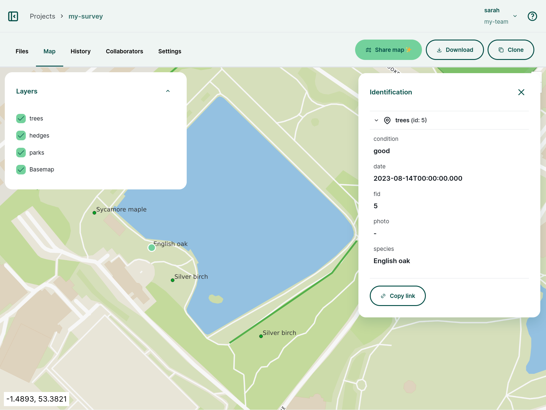
The Layers panel lists all layers displayed on the map. The check button ✅ controls the visibility of layers.
Click on a feature on the map to display its properties.
Sharing maps via URL early access
Early access feature
Map sharing is in early access. If you would like to try it out, fill in this form to gain access to this feature.
Try out this example link to see how shared maps work.
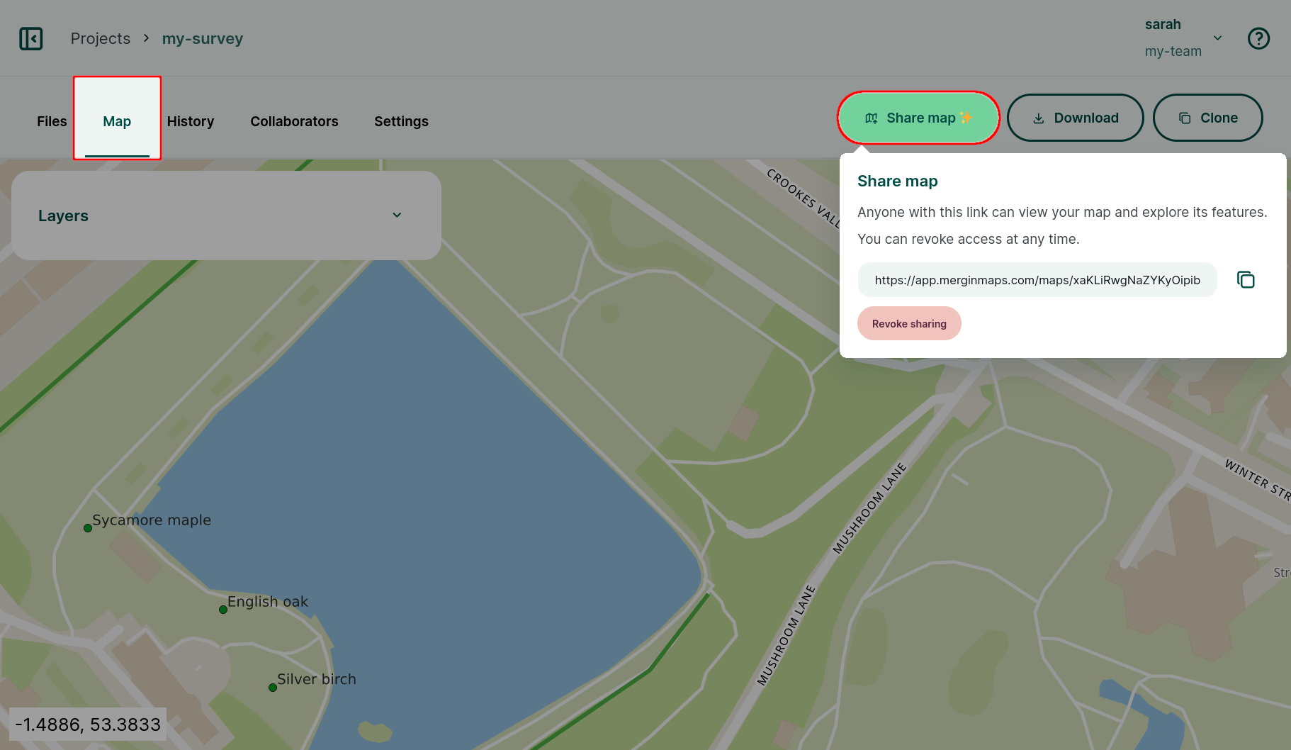
Webmaps can be shared via URL. Admins or owners can enable map sharing for a project, so that anyone with the link can display and explore your project in a web browser, without the need to log into Mergin Maps or making the project public.
- Navigate to your project on the dashboard.
- In the Map tab, click on the Share map button to generate a shareable link
- Send the link to anyone to share your project
To disable the map sharing, click on the Revoke sharing button.
Blog about shared maps
You can read about this functionality in our blog post A final surprise for the year - shared maps via URL.
Webmaps extent
The extent of webmaps is defined in QGIS in the Project Properties.
When displaying maps on the dashboard, Mergin Maps uses primarily the project full extent defined in the View Settings tab.
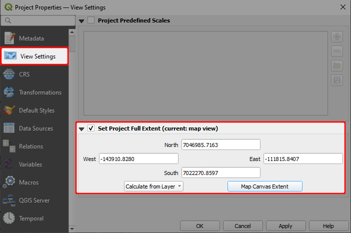
If this parameter is not defined, the map extent will be set as the Advertised extent from the QGIS Server tab.
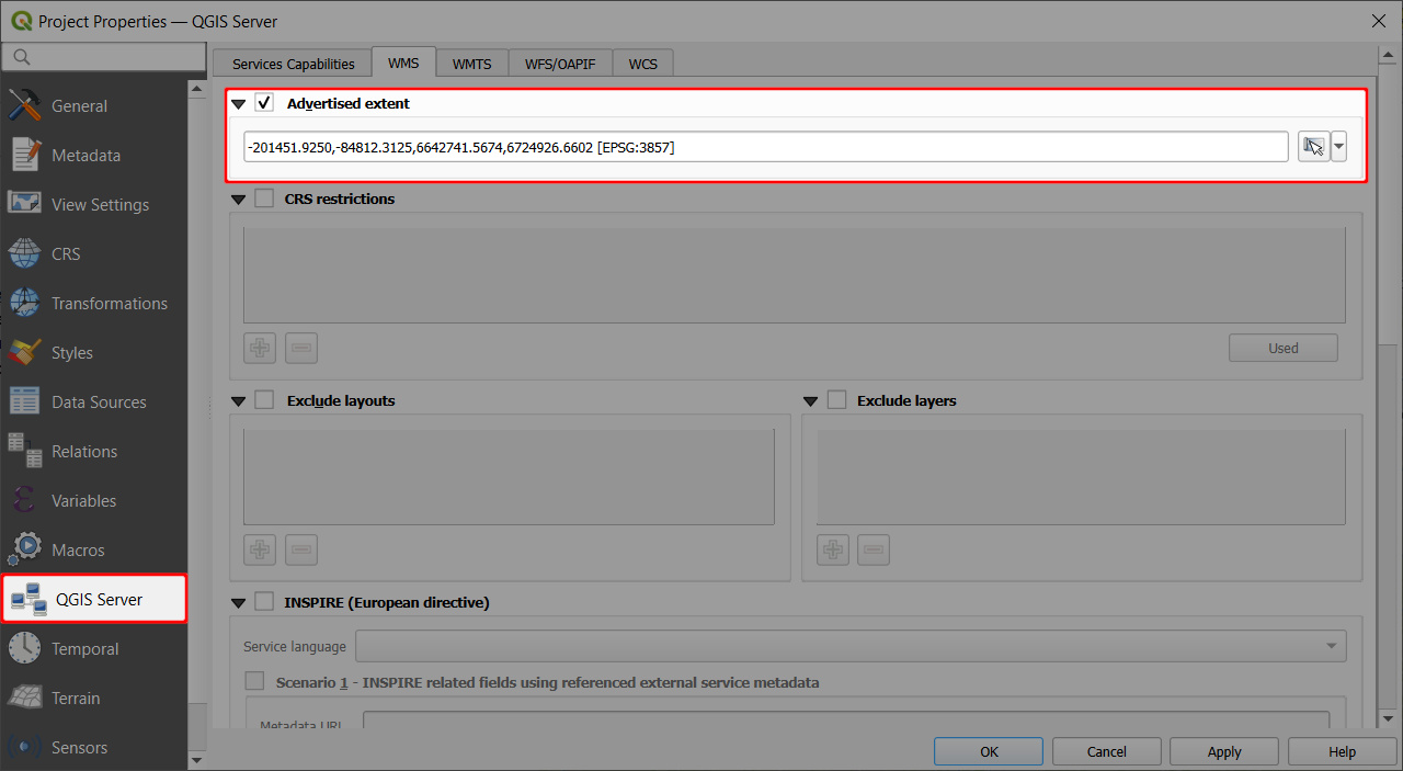
If there are no extent settings in the QGIS project, Mergin Maps will calculate the extent from layers in the project.
Troubleshooting
Map config does not exist
The Map tab of a project on the dashboard may display this error message: Map config does not exist, please try update the project

This usually happens when the map was not initiated. All you need to do is to create a new version of the project: synchronisation of the project will activate the map content.